We help Colombian exporters of cattle products, cocoa, coffee, palm oil, rubber, soy and timber meet EUDR requirements — with geospatial traceability, risk analysis and audit-ready reports.
Building a traceability platform? See our APISince late 2026, the EU requires every shipment to prove it doesn't originate from deforested land. Without that proof — technical, geo-referenced and auditable — there is no access to the European market. Most exporters have their data scattered, and not in the format Europe requires. That's what Socrates Data solves.
Specialized solutions so your exports meet the market's toughest standards.
Satellite analysis of 5 plots using Sentinel-2. We identify post-2020 deforestation risk, coordinate errors, and overlap with alert zones. Executive report with risk classification in 72 hours.
GPS data cleanup and verification, post-2020 forest-cover analysis with Hansen GFC and Sentinel-2, territorial risk assessment (indigenous reserves, conflict zones, land tenure), and due diligence statement in GeoJSON format for TRACES.
Complete supply-chain mapping from plot to export. Compliant polygons, auditable DDS report, and support presenting to European buyers.
Most EUDR risk tools rely on the EU's generic country-level risk classification. Forest Risk Stress Test is built directly on Colombian data — IDEAM's forest baseline, Hansen post-2020 loss, Sentinel-2 NDVI trend, MapBiomas land cover and WDPA protected areas — combined with Colombia's own legal and territorial rules (UPRA agricultural frontier). That's the difference between knowing a country is "high risk" and knowing which specific parcel is.
If you already offer traceability or due-diligence tooling to European operators, Colombia is likely a gap: generic country-level EU risk classification doesn't capture the legal, territorial and deforestation context that Colombian supply chains actually require. Socrates Data's risk engine plugs into your existing platform via a REST API — you keep the client relationship, we supply the Colombia-specific rule engine underneath.
IDEAM forest baseline, UPRA agricultural frontier, national protected-area and indigenous-territory layers — not a generic global classification.
Parcel-level risk requests return a structured LOW/MEDIUM/HIGH classification with supporting evidence, ready to embed in your own reports.
We don't build end-to-end chain-of-custody or supply-chain mapping — that's your platform's job. We supply the depth your Colombia coverage is missing.
This is what the analysis we'd deliver for your operation looks like. Request it and we'll send it within 24 hours, at no cost and with no obligation.
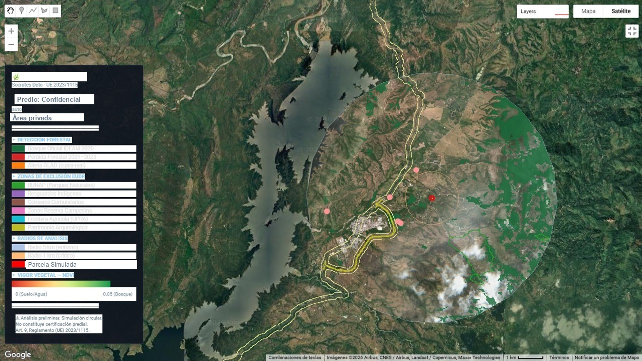
This real report on a confidential plot shows how our analysis engine verifies boundary accuracy, cross-checks independent satellite records to confirm the absence of recent deforestation, and evaluates territorial overlap and local legality risk in complex areas of Colombian territory.
📧 Delivered by email · No cost · No obligation
Stress-tests carried out in the field. Plot and landholder identities remain strictly confidential.
🔒 Plot, landholder and result information protected under confidentiality agreement.
Book a free 30-minute diagnostic session. No obligation.
We'll reach out within the next 24 hours to schedule your session.